Now that summer has come and gone, the traffic has slacked a little, and the lack of thunderstorms makes everyone's life easier. Its amazing what we can do as air traffic controllers when we can use our entire sector, we can count on aircraft hardly straying from thier route of flight, and storms aren't randomly shutting down high-demand airports. It's fun running planes close together, knowing its smooth and clear out there.
Just when we're all settled in and comfy with our fall traffic flows, the wind picks up, the big cold fronts roll in, and once again, we're reminded just how crummy the weather can be, even if it doesn't involve convection. I think bad ride days take more of a phyical and mental toll on me more than tons of planes deviating around weather. It feels that way, at least, now that we've been thunderstorm free for a month or so.
It all started last Sunday morning. Normally Sunday mornings are slow as slow can be. A few VFR's here and there, a few departures early in the morning, and then we just take breaks until about 11am when the traffic picks up a little and the international arrivals come in through Albany sector. Even so, its still not weekday traffic by any means. I've even gotten through it without a D-side once or twice.
The winds over upstate NY and northern VT and NH were lightly blowing out of the north. This light breeze then got caught up in a blast of air flowing northeastbound over CT, RI, and out over the Gulf of Maine. This air speeding up and making a hard left turn at Harford meant only one thing...Severe turbulence. The worst of it was between FL230-270, with slightly less horrible Moderate turbulence above. Planes will fly through almost anything, but not severe turbulence. Severe turbulence hurts things: planes and people. So, pilots avoid it like the plague. Many of the departures from Boston and around New England that normally climb through that area above Albany sector declined any higher altitudes until they where really, really, really certain they'd stay out of the bumps.
So, there I was sitting at Albany sector, taking handoffs on the line of Newark arrivals, a Stewart lander, two Albany departures, two Manchester arrivals, a Bradley prop arrival, a Teterboro arrival, two Providence arrivals and an MD80 going BOS-Dallas at FL200. In trail of the Dallas jet was a Toronto arrival also at FL200. The Manchester and Providence arrivals are fine, they just descend to FL190 and are handed off to the BOSOX sector in Area C. They do interrupt a few times, asking about that severe stuff over CT they're heading towards. "You should be below it," I offer, and they seem relieved by my answer.
Getting the Stewart arrival below the Teteboro arrival who goes below all the Newark arrivals so I can get the Albany departures above them all is the normal task of this sector anyways. Its those two pesky overflights at FL200, cutting right through every one trying to go from FL240 to 12000, 14000, and 16000 respectively, that is forcing me to issue twice as many clerances as normal. The Albany departures get stopped at FL190 below the overflights until I can vector them out from under. Each arrival gets FL210 initially and I go over the top. Just then a Bradely jet arrival approaches from the west, descending out of FL260 to FL180 but aimed right at my two Albany arrivals climbing. I start the BDL prop arrival down to 13000 right away, and give him a little shortcut to go behind the two overflights. I ask my D-side to call Delancey, who is giving me the Bradely jet, and stop that plane at FL230. I put the two departures on a southwest heading and climb them to FL220. A second Bradley jet flashes to me next, and my D-side and I opt to go UNDER the departures with that one. I turn the Stewart arrival on the parallel heading between the Albany departures and the Newark/Teteboro flow. I get a quick two seconds between listening for a clearance readback and my next transmission to bask in the beauty of 4 parallel streams of descending and climbing traffic heading southwestbound.
As the arrivals clear the aforementioned overflights, I push them down under the second Bradley. One of the Newarks is still high, so I turn him south a little to give the Newark a few more miles to descend. My second Albany departure is climbing slow and might not clear either the Bradley or the Newark, so I turn him eastbound to give him a few more miles to clear, and then a LaGuardia arrival comes in from above. I have to get the LGA arrival "swapped out" below the second departure who is going to JFK. My D-side calls the high sector and gets control for me to turn the LGA arrival eastbound. That ALB-JFK flight is above his traffic now, turning south, and then I push the LGA down over the first BDL who is now descending out of FL230 for FL180. I managed through, and curse the bad rides in the high sectors.
Since then, the rides have just been bumpy. Nothing severe since, but its just been miserable flying. Today's dayshift saw lots of heavy precipitation, spurring icing conditions and very choppy rides. A few aricraft deviated around some of the heaviest rain, but it was all very random. I kept planes as far apart as I could, to allow them to slow down, speed up, descend at thier leisure, and devate around cells that looked unpleasant. There was no way out of it, and smooth rides where hard to come by. Even if the traffic is relatively slow, as a controller I am constantly asking planes how thier rides are, relaying previous reports, and making suggestions based on my overal feel for how things are developing. The pilots just can't get enough pilot reports and they always want to look for the greener grass at some other altitude. And God help you if you get ONE good altitude that is smooth. Every single airplane in your sector will want it. But they can't have it. Not if you want everyone to live.
Off to work the midnight shift....
DM
October 26, 2008
October 18, 2008
ABRV8 this!
I've been writing on this blog for almost two years now, and I'm just now starting to pinpoint my audience. I appreciate all of you for reading, commenting and emailing me your thoughts and experiences. While I do my best to project the mental image of the traffic I deal with everyday, perhaps I need to backup a little and cover the basics of my area of specialty for those of you not intimately familiar with the map I had to draw back in Radar school. While my first instinct was to simply put up the map of the airspace, that definitely won't give everyone out there instant situational awareness. But have a look.

For those NOT in the aviation industry, and even for those who are, it is stunning how many abbreviations we use on a daily basis.
The normal world uses 2 character abbreviations for airlines. UA - United. B6 - jetBlue. AA - American. Not us. Each airline is designated a THREE letter identification which is associated with a radio callsign. The associated regional carriers that fly the smaller jets and turboprops are actually separate airlines and are referred to as such, and I'll include those lower in the list. Keep in mind, every time a controller see the three letters on the left, they immediately think of the radio callsign on the right in quotes. The actual airline names in the middle are of no consequence.
AAL American "American"
UAL United "United"
AWE Former America West, now merged with UsAirways "Cactus" (Long story)
JBU jetBlue "Jetblue"
NWA Northwest "Northwest"
COA Continental "Continental"
DAL Delta "Delta"
SWA Southwest "Southwest"
TRS Air Tran "Citrus"
BAW British Airways "Speedbird"
DLH Lufthansa "Lufthansa"
FDX Fedex "Fedex"
ACA Air Canada "Air Canada"
EGF American Eagle "Eagle flight"
CHQ Chautauqua "Chautauqua"
LOF Trans States "Waterski"
RPA Republic "Brickyard"
FLG Pinnacle "Flagship"
TCF Shuttle America "Mercury"
COM Comair "Comair"
GJS Gojet "Lindberg"
AWI Air Wisconsin "Air Wisconsin"
JZA Air Canada Jazz "Jazz"
BTA ExpressJet "Jetlink"
FRL Freedom "Freedom air"
ASH Mesa "Air Shuttle"
WJA West Jet "Westjet"
EJA Netjets "Execjet"
OPT Flight Options "Options"
This is a very impartial list, but gives you the sense of all the different airlines we deal with.
There are 30 sectors in Boston Center, and each area of specialty owns 6 sectors each. These sectors are labeled using a number and a name. Some of the names are then abbreviated based on the location identifier the sector is named for. I work the following sectors:
Sector 08 - Watertown (ART)
Sector 09 - Utica (UCA)
Sector 10 - Rockdale (RKA)
Sector 22 - Albany (ALB)
Sector 23 - Hancock (HNK)
Sector 24 - Delancey (DNY)
We always use the sector number when flashing a hand off to that sector, and refer to either number or name when talking to other controllers. I tend to use the name of the sector in this blog for easier reference.
And then there are all the location identifiers. In almost all cases, we have three letter abbreviations for VORs and four letter codes for the actual airports. Five letter codes are used for computer based fixes and intersections (the intersection of two radials off two VORs), but I won't list them here since there are thousands, and they aren't really abbreviations anyways, although they can be very creative.
Lists of abbreviations are scattered all over the place. Every FAA document lists the abbreviations as the first chapter so we have a reference. Heck, there is an entire tome of contractions right here. Then, for all the fixes, try Airnav.
The following are highly used VORs that I use often in this blog and are prominent in my area:
YOW - Ottawa, Ontario
YUL - Montreal, Quebec
ART - Watertown, NY
MSS - Massena, NY
SLK - Saranac Lake, NY
GFL - Glens Falls, NY
ALB - Albany, NY
CTR - Chester, MA
BDL - Bradley/Windsor Locks, CT
CAM - Cambridge, NY
UCA - Utica, NY
SYR - Syracuse, NY
BUF - Buffalo, NY
ROC - Rochester, NY
ITH - Ithica, NY
GGT - Georgetown, NY
RKA - Rockdale, NY
HNK - Hancock, NY (yes, these are all real places!)
DNY - Delancey, NY
LHY - Lake Henry, PA
LVZ - Wilkes Barre, PA
CFB - Binghampton, NY
PSB - Phillipsburg, PA
PWL - Pawling, NY
IGN - Kingston, NY
GDM - Gardner, MA
EEN - Keene, NH
BOS - Boston, MA
ENE - Kennebunk, ME
Then, there are the airports. Airports have a four letter identification in most cases. All the main airports start with a K in the US, and C in Canada. Very small airports sometimes have numbers in them as well, which I find hard to remember. Often times, the airport identifier is the same three letters as the nearby VOR identifier plus the K or C. Keep in mind, it works the other way as well. In the following list, the VOR is often just the last three letters of the airport code.
I'll start with the airports that my area provides approach control services to:
KOGS - Ogdensburg, NY
KMSS - Massena, NY
KMAL - Malone, NY
KPTD - Potsdam, NY
KOIC - Norwich, NY
N66 - Oneonta, NY
N23 - Sidney, NY
Then there are the local regional airports:
KBTV - Burlington, VT
KMHT - Manchester, NH
KPVD - Providence, RI
KPWM - Portland, ME
KBED - Bedford, MA (busy GA airport)
KBGM - Binghampton, NY
KRME - Griffis/Rome, NY (GSS Approach is the reference on the map)
KBGR - Bangor, ME
KOXC - Waterbury, CT
KBDR - Bridgeport, CT
KSWF - Stewart, NY
KAVP - Wilkes Barre, NY
And the following are the major airports in the eastern half of the US:
KBOS - Boston, MA
KLGA - LaGuardia, Queens, NY
KJFK - Kennedy, Queens, NY
KEWR - Newark, NJ
KPHL - Philadelphia, PA
KIAD - Dulles, VA (Washington, DC)
KDCA - Reagan/National, Washington, DC
KBWI - Baltimore Washington, Baltimore, MD
KORD - Chicago Ohare, IL
KMDW - Chicago Midway, IL
KCLE - Cleveland, OH
KDTW - Detroit, MI
KCVG - Cincinnati, OH
KPIT - Pittsburgh, PA
KATL - Atlanta, GA
KCLT - Charlotte, NC
I wouldn't want to leave out the Canadians, eh?
CYYZ - Toronto
CYOW - Ottawa
CYUL - Montreal
CYQB - Quebec
CYQA - Muskoka
CYHM - Hamilton
CYHZ - Halifax
Of course, this is not a complete list by any means. However, I will feel obligated to use these above listed fixes in future posts without explanation! I may also continually update this list as I see fit.
In addition, if you see a "FLxxx" that stands for Flight Level. Basically, just add two zeros on the end and there you have your altitude. FL300 is 30000 feet. FL190 is 19000 feet. This is only FL180 and above, as the actual use of Flight Level refers to the fact that regardless of atmospheric conditions, all aircraft set their altimeters to a standard setting of 29.92 millibars above 18000 feet.
Thanks for putting up with a simple reference post, but there is more air traffic on the way.
Until next time...
DM
October 4, 2008
The Numbers Lie!
Yesterday was busy. When I first arrived to work at 2pm, I was able to chill out at Albany D-side for a few minutes. Then, we "went to one" at Albany and I was told to open up Watertown sector. Watertown is normally combined at the Utica sector, especially this time of year, since most of the airplanes that traverse Watertown also get Utica invovled as well. Thus, it's usually easier to just keep them combined and work all the airplanes together. Allow me to explain:
Watertown owns more airspace than Utica...alot more. They are adjacent to 3 different centers in two countries, and it overlies 3 approach controls. The Watertown sector used to only be one sector, before Utica was invented. Utica now only owns the high altitudes along J547, which is a major westbound airway. Watertown doesn't work as much traffic, quantity-wise, as Utica, but Watertown's airspace is much higher maintainance. Most of the planes in Utica sector are in level flight, crusing along in the same direction, rarely in conflict. There is, however, in-trail spacing to midwest airports that must be accomplished, although the vectors for spacing required often occur near or inside of Watertown's airspace, defeating the purpose of opening up Watertown. Watertown works a lot of slow prop planes and descending jets flying in all directions, military jets, arrivals and departures from small airports in upstate NY, and they coordinate with Montreal and Toronto Centres - See MEOWWW.
Since Utica is relatively new to the world, we're still in the process of working out all the "kinks". Upon conception, or shortly after, the Utica sector owned FL280 and above, as does its bordering friend, Rockdale sector. This made it relatively easy to visualize the airspace in our heads. Cleveland Center has thier sectors split at FL330 and above to the west of us, and the other Boston Center area to our east is split at FL240 and above. While this seems confusing, it makes sense as aircraft tend to descend into the airports on the coast to the east.
A year or two ago, however, management found a computer program that would take a busy period at Watertown/Utica and replay it, moving the airspace borders and altitude splits around, trying to find a happy medium where, when split up, Watertown would work the same QUANTITY of airplanes as Utica. They finally settled on Utica owning FL310 and above. While they were busy trying thier best to keep everyone "productive" (on position working lots of airplanes), they didn't realize that 15 airplanes in Watertown is lot harder to work than having 15 airplanes in Utica. Oh, and the best part is, the only way to actually even out the traffic flow would be to restrict all aircraft landing in Cleveland to FL300 or below, "forcing" them into Watertown sector. Utica would not have to worry about Cleveland spacing. Watertown now has to worry about Cleveland spacing, approaches, and coordination, and a much higher complexity of traffic overall. This is thier plan, and they're sticking to it, regardless of other factors that come up on a day to day basis. Traffic from the past, run through a simulator, is now running our traffic of the future, with no real time re-evaluation.
So, yesterday, Watertown is combined with Utica, and they are BUSY. The supervisors gather and discuss, deciding to split off Watertown. And so, there I sit, at our most fabulous, newly designed Watertown sector. There is Cleveland spacing, of course, and I get to work them all, forced to cruise at FL300, the top altitude in that part of my sector (the southern half which is below Utica). The northern part of the sector is still surface to FL600. Appraently, the reason the sector was going to be busier than normal is becuase all of the overseas arrivals to PHL and IAD are approaching from the north. They are all flying southbound over SYR. The Cleveland arrivals(and a bunch of other traffic) are flying westbound over SYR at the same time. PHL arrivals are coming down out of Canada at FL380 and FL400, along side (or sometimes under and over) IAD traffic. PHL arrivals need to enter the Delancy sector FL260 and below (at SYR, basically), and the IAD traffic has to enter Rockdale or Delancy at FL300 or below (again, at SYR). So, I'm getting busy, with traffic that I have to descend to FL300, crossing with traffic that should be higher, but is restricted to FL300 to "even out" my workload. This issue is brought up to the folks in charge, but to no avail.
Here comes an IAD lander, crossing with an CLE arrival stopped at FL280, below an ORD lander at FL300, since he can't go higher than the ORD in this configuration, as per management restriction. The CLE arrival wants FL300, but can't have it yet. The IAD and ORD planes are tied at SYR, and while I'm debating a solution, a Korean jet bound for Korea comes in from the south, also at FL300. I am taking a PHL jet down below them all to FL260, as I need to anyways, so he's not a factor.
I call Utica, who owns above me, to point out the ORD lander climbing to FL320. "Climbing to FL320 approved, radar contact". He'll work the ORD guy once I'm clear of traffic. I'll still have the Korean and the IAD lander to deal with in a minute. "Lindburg 5336 climb and maintain FL320, crossing traffic". "Unable, too heavy today". WHAT! Its VERY rare for a jet flying under 2000 miles to be capped so low due to any reason. Plan B time.
The CLE is just gonna have to stay at FL280 for a while. I take the PHL guy down to FL240, and then push the IAD lander down below everyone to FL260. The ORD guy then gets FL290, which is not normal for westbound flight, and let the Korean Air run at FL300. Cleveland Center has opposite direct BTV traffic at FL290, so I turn the CLE guy left to get him away from the ORD lander, and then take the ORD flight down to FL280. My D-side takes a few more handoffs and its round two of pushing these overseas jets down below my westbound regional jet traffic. All the while, Utica is just working some airplanes westbound without any fuss.
Every one of these descending IAD and PHL arrivals have to be pointed out to Utica since they don't get below FL300 in time to miss Utica airspace which extends about 20 miles north of SYR. So, Utica has to watch all my airplanes anyways. This situation is much more complex, and often confusing (since we're not used to working this airspace all the time), and we all can't help but agree that we're better off when the two sectors are combined in most cases. The chances of mistakes goes way up with the split sectors.
It would just be nice if we could be flexable enough as a team so that we don't go out of our way to put flows of aircraft in the same place at the same time when its unnecessary. Just becuase the traffic numbers were even from a Tuesday last year, doesn't mean we're all putting in the same effort today or tomorrow, or that its safer this way.
DM
October 1, 2008
Installment Number 2
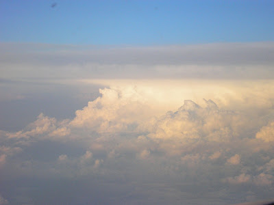
Sam took these great shots en-route from Dallas to Minneapolis while deviating over Kansas last Tuesday. Thanks buddy!


Until next time....
DM


Until next time....
DM
Subscribe to:
Posts (Atom)